October 09, 2026



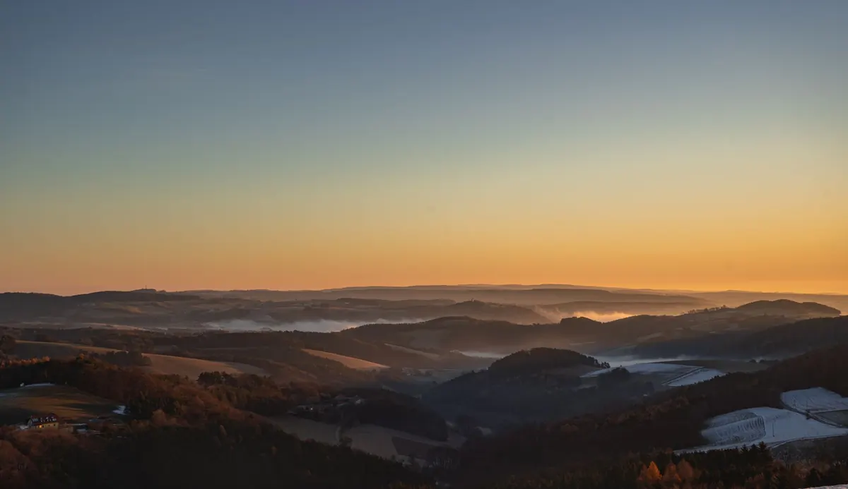
Long before sunrise, a valley can look like a lake. Fog fills the low ground, hides the river, and leaves the ridges sharp against a pale sky. For hikers, that scene is not just beautiful. It is a set of clues. Valley fog follows patterns you can learn from a forecast, a topo map, and the feel of the air when you step outside. Read those clues well and you can choose a trail that rises above the cloud, or time your start so you are not breaking trail through wet brush for three miles.
Most morning valley fog is radiation fog. It forms when the ground cools overnight, chilling the air just above it. That air loses its ability to hold moisture, and the moisture condenses into tiny droplets. Three conditions make it likely:
When those line up, fog forms in the lowest parts of the valley first. It pools and thickens in the same places night after night.
The key number is the gap between air temperature and dew point. The dew point is the temperature at which air becomes saturated. If the forecast shows an overnight low of 48°F and a dew point of 46°F, the air only needs to cool two more degrees. Fog is a safe bet. If the dew point is 38°F and the low is 50°F, the valley likely stays clear.
Fog usually thickens in the coldest hour before dawn. It may start as a thin ground haze, then deepen until it swallows fence posts and trail signs. After sunrise, the sun warms the valley floor. The fog lifts, thins, and often burns off from the edges inward. On some mornings it rises into a low cloud deck below the ridges. On others it vanishes quickly.
Cold air also drains downhill. At night, air on the slopes cools and slides into the valley, where it pools like water in a bathtub. That is why a trailhead in a canyon bottom can be socked in while a bench a few hundred feet above is clear. If you want a view, you usually want to climb.
Rivers and lakes are fog factories. Water holds its temperature better than land, so the air just above a river can be warmer and wetter than the air on surrounding hills. When that moist air meets cooler ground, fog forms. The result is a ribbon of white along the water, sometimes thick enough to hide a bridge.
Use a map to find these ribbons. Look for the main river, then the tributaries, ponds, and marshy areas that feed it. A trail that follows a creek will often be wetter and foggier than one on a nearby ridge. A trail that crosses a river bottom may start in dense fog and climb into sun within twenty minutes.
Wind changes the picture. A light down-valley breeze can push fog along the river corridor, so it reaches farther than expected. A cross-valley wind can pile it against one slope and leave the other side clear. If you are choosing between two trails, check wind direction as well as water nearby.
Valley fog has a top. That top is often called the fog line, and it can sit anywhere from a few feet above the river to several hundred feet up the valley walls. Below it, visibility drops and everything drips. Above it, you may find dry rock, open views, and a sunrise that feels private.
Elevation gain is your simplest tool. A trail that climbs steadily will usually take you out of the fog. A trail that contours along a low slope may keep you in it for miles. Before you go, estimate the fog line from the overnight low and the terrain. If the valley floor is near saturation and the ridges are warmer, expect fog to fill the bottom and thin as you go up.
There are exceptions. Sometimes fog forms high as upslope fog, or a cloud deck settles onto the ridgeline. Then the valley may be clearer than the summit. A quick look at a webcam, a local forecast discussion, or the sky from your driveway beats any rule of thumb.
You do not need a weather station to make a good guess. Run through these checks while the coffee brews:

Stories and insights from the valley.
Copyright © 2026 Vale Column. All rights reserved. Vale Column.